Sharing our (me and my mom) 6 Days/5 Nights Hong Kong and Macau Do It Yourself Itinerary. This is dated way back August 2013 so the prices indicated are not applicable today anymore.
Friday, January 1, 2016
Thursday, December 31, 2015
Riverside Inn Iloilo City
We found out about this inn because we have a colleague who is from Iloilo. This inn is located just in from of University of San Agustin which is less than 4kms away from the city proper, just one jeepney ride away; also is one jeepney ride from SM Iloilo, minimum fare.
The inn is pretty basic which is fair enough for the cheap price we paid. The room amenities are basic as well but good enough for two nights stay. I am impressed with the spacious toilet and bathroom which is usually compromised in most cheap inns. They don't have a grand lobby and signage in front so you could miss this easily. There are food stalls at the ground floor and it is on the main road.
Here are some of the photos I got for our room:
Thursday, April 17, 2014
Mt Isarog : Panicuason Trail
Warned by a friend that this mountain is a major climb and since I love adventures, I give it a go. honestly, I have no idea what a major climb really is. Despite having nervousness in mind, I see that this would be just another challenge for my climbing stint.
It was June 2013 when we climbed this mossy and lush rain forest mountain. From the Naga City Bus Terminal, we took a tricycle going to the city public market area where we took a jeepney going to Barangay Panicuason. At the jeepney's turn-about we met our tour guide and started our trek to the majestic mountain of Naga City. Trees are everywhere! This is why I so loved this mountain. But adjacent to this realm is the high presence of "limatik" or parasites up to their so-called base #2. There is also a part of the trail where only huge and tall bamboo trees are all over the place. Oftentimes, you would also jump or hop off large fallen trunks of trees along the way. Another major feat of this trail (for me) is to like rock climb about one-storey high rocks or boulders which is almost 90 degrees inclined; going down this steep part is my most unforgettable part in this climb. There are also water sources along the trail, particulary in base 2 (?) and base 3 where we camped.
| base #3 is the last and topmost base where you can camp overnight |
We started our climb from the jump-off at about ten in the morning and reached base #3 at around four in the afternoon. I think it would be faster if I didn't had minor muscle cramps which partly delayed the group. Water wasn't really an issue during the climb since (1) the trail is almost purely covered with trees and (2) it was cloudy at that time. Actually, we forgot to buy some rice at that time yet survived the whole day trek without any carbo-loading from rice. The next day, we hiked on to the summit for two hours from base 3; leaving our bags and things there.
| at the summit, still surrounded with trees |
| no clearing for us on that day |
| parts where you can hardly see the trail |
Before reaching the jump-off on our descent, we made a stop-over to its falls; i just forgot its name. Entrance is free and many locals are having their family picnics here. The water is really cold and gets very deep near the falls.
| the falls right next to jump-off |
Tuesday, April 15, 2014
Mt. Malipunyo-Mt. Manabu Day Hike
From the foot of Mt. Maculot the other night, we traveled to Lipa City then from Lipa Terminal we hired a mini-cab going to the foot of Mt. Malipunyo. Here lives our tour guide for the next day's hike and here we will be spending our night.
| the backyard of our tour guide and where we pinched our tents |
At 6am, we started out trek. The trail at first were a bit moist due to overnight's dew. The trail is abundant with lush green trees which I liked the most. We also came across at least 3 water source so we haven't had any problem with re-hydration.
Before reaching Mt. Malipunyo's summit, we came across two peaks where you can have rest at. There is also a very challenging trail which is around 75 degrees inclined where you would only rely on the roots of the trees and to give it a more quirk, the presence of mud all over the trail. They have named it after a famous Filipino bad expression since you would glad saying it after you pass the trail.
| Mt Malipunyo's summit view |
| Mt Malipunyo's summit view |
From Mt. Malipunyo, there would be just a slight descent inside the rich forestry and would go straight to a series of mountains before reaching the Mt. Manabu's foot. We also pass by a tree house where the owner is our tour guide's mother. Here, we were served with hot native coffee and boiled cassava for free! It is always good to taste fresh and native delicacies straight from the plantations. Aside from that, I am also amazed seeing wild fruit-bearing trees such as lanzones and rambutan.
| named as Susong Dalaga (a teenager's breast) |
| you would came across this scenic view and mountain-top before reaching the Mt. Manabu summit; from here you could see the summit as well |
Before reaching Mt. Manabu's summit, be prepared for tall grasses and plants which could slash any part of your body along its way. Be covered!
| Mt Manabu's summit view |
| Mt Manabu's summit view |
| Mt Manabu's summit view |
| Mt Manabu's summit view |
The descent form Mt Manabu's summit can be swift and easy. There is also another water source along the way from a small nipa hut. Before reaching the end, there is a couple living in the area who will offer you another native coffee (kapeng alamid) for free! Then at the end of the trail, we washed up for Php10 at a local's house. Electricity is now present in this area. There are also tricycles in this area who will ride you back to Lipa City Terminal.
Friday, April 11, 2014
Mt. Maculot : Rockies-Grotto Traverse
This I would tag as my baptismal climb. I have no idea what to expect or to feel but all I want is to be with nature. My mountain climbing/hiking/trekking history starts from here.
Our meet-up was at JAM Bus Terminal - Buendia. Rode a bus bound to Cuenca and I think we were dropped off at Cuenca Town Market. From there we rode a tricycle to the Mt. Maculot jump-off. Travel time is roughly under 3 hours. It was a fair Saturday morning.
The trail...They said that this mountain is apt for beginners but I am shocked feeling off the edge of quitting my climbing stint somewhere in the middle. That time I realized that my lower body strength is one of my weakness. This is the part before the "Rockies" having huge steps and felt my thighs are close to being numb.
The Rockies...this is the most famous part of Mt. Maculot where you will have a spectacular view of Batangas. It is called Rockies because as its name implies, it is of pure rock (almost 1005 rock) so just be careful wandering around this area as it may be slippery and dangerous especially on the edges.
The Summit...I was quite disappointed with Maculot's summit as you wont see a thing. There are high but not huge trees blocking every view you could think of. It is also unsafe to climb up the trees to get a view since it can't hold on an adult's weight.
| this ain't the summit but the trail going to it, large and huge trees and grasses |
| on descent, you will experience a semi-rapelling stint |
The Grotto...from the summit starts the descent to the traverse trail leading to a Grotto on a hill. Another fantastic view from here, good to cap off your Mt. Maculot climb.
| view at the grotto |
At the first community at the foot of Maculot, we were able to wash up in a resort for Php50. They also sell some refreshments and foods to recuperate your thirsty mouth.
Sunday, January 19, 2014
Boracay's Treasures
Here are my keychains and cellphone blings from the Island paradise of Boracay. Most of them are gifts from friends.
| a shell and some sands |
| sands and shell combidation too |
| colored sands? or salt? |
| collection of different sea creatures |
| shells and colored sands |
| traditional Filipino banca |
Sunday, November 3, 2013
Biak na Bato Day Tour
Looking for a quick out-of-town day tour for our balikbayan relatives, we opted to go to one of the Philippine's neglected historical site - the Biak na Bato National Shrine in San Miguel, Bulacan. You may do your own homework on what about this place that played a vital role in our past.
Leaving from Makati City, it took us about 3-4 hours in order to reach the place. There are no visible signboards along the way so make sure you do your research eagerly. I forgot the exact amount of per head entrance fees and tour guide fee but on my rough estimate it is about Php50 per head and Php200 per tour guide. I'm not sure if they allow visitor to explore on their own since the path is pretty straight-forward. I've read some blogs before that you can swim in the river here but during our time, the river is splashing with mud from the mountain since it just rained the night before. The over-all tour of the area is approximately 1.5-2hrs with not all the sites are allowed for tourists.
Here are the scenic and the not-so-scenic views of the place...
The walk path has been cemented so trekking shoes are not that necessary. There were steeps encounters but even our senior citizens able to reach the end with just some hesitations; but there is just one place that is not paved that scared them not to continue.
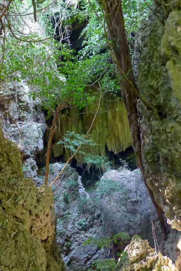
| the biggest and grandest caves of them all..the final stop |
I just felt so bad seeing all the vandalisms in the area and the area is not properly conserved anymore and maintained. I hope sites like this would be preserved by the government for the generations to come.
Subscribe to:
Posts (Atom)